

Guide: Välj rätt sjökort till din enhet
Det finns många alternativ – som Navionics, C-MAP och flera andra – men vilket är egentligen rätt för dig? I vår film går vi igenom skillnaderna mellan de vanligaste sjökorten och visar vilka fördelar de har för både fiske och båtliv. Perfekt för dig som vill känna dig trygg på vattnet och få ut mer av din plotter.
Chart
At Kayakstore.se you can find an extensive range of charts for your plotter. Using charts is essential to increase safety and optimize your fishing when you are out on the lake. We strongly recommend that you invest in a chart that fits your specific device.
Are you looking for chart the Baltic Sea , chart Karlskrona , nautical charts kattegatt , Danish nautical charts, Finnish nautical charts or nautical charts in other parts of Europe, we have something for you all to offer!
We have charts for your plotter from many of the most well-known brands such as C-Map , Blue Chart, Navionics Charts , Garmin Charts, etc.

Original price
7 490 kr
-
Original price
7 490 kr
Original price
7 490 kr
7 490 kr
7 490 kr
-
7 490 kr
Current price
7 490 kr
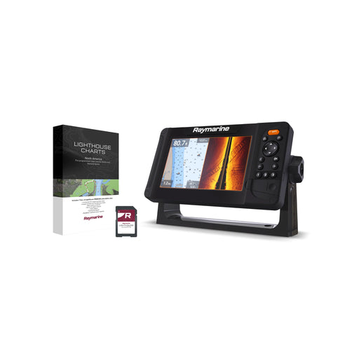
Raymarine Element 7 S - 7" MFD med Wi-Fi, GPS & LightHouse sjökort över norra Europa
Raymarine
Out of stock
Raymarine Element S-serien är din nyckel till smidig och prisvärd prestanda på sjön. Med en kraftfull fyrkärnig processor och en snabb och exakt 1...
View full details
Original price
7 490 kr
-
Original price
7 490 kr
Original price
7 490 kr
7 490 kr
7 490 kr
-
7 490 kr
Current price
7 490 kr
Sold out
Original price
2 719 kr
Original price
2 719 kr
-
Original price
2 719 kr
Original price
2 719 kr
Current price
2 199 kr
2 199 kr
-
2 199 kr
Current price
2 199 kr
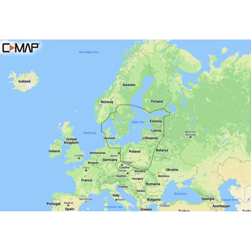
C-MAP REVEAL Baltic Sea & Denmark Demo
C-MAP
Out of stock
Reveal M-EN Y299 Baltic Sea Most of Sweden (with western Jämtland partly gone and not quite at the top of the North) and Denmark with parts of N...
View full details
Original price
2 719 kr
Original price
2 719 kr
-
Original price
2 719 kr
Original price
2 719 kr
Current price
2 199 kr
2 199 kr
-
2 199 kr
Current price
2 199 kr
Sold out
Original price
2 789 kr
Original price
2 789 kr
-
Original price
2 789 kr
Original price
2 789 kr
Current price
1 799 kr
1 799 kr
-
1 799 kr
Current price
1 799 kr
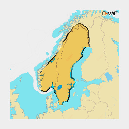
C-MAP REVEAL X Norges & Sveriges sjöar Demo
C-MAP
Out of stock
C-MAP Reveal X levereras i SD-adapterformat, vilket gör den enkel att använda med enheter som använder Micro SD-kort. Observera att den endast är k...
View full details
Original price
2 789 kr
Original price
2 789 kr
-
Original price
2 789 kr
Original price
2 789 kr
Current price
1 799 kr
1 799 kr
-
1 799 kr
Current price
1 799 kr
Sold out
Original price
17 990 kr
-
Original price
17 990 kr
Original price
17 990 kr
17 990 kr
17 990 kr
-
17 990 kr
Current price
17 990 kr
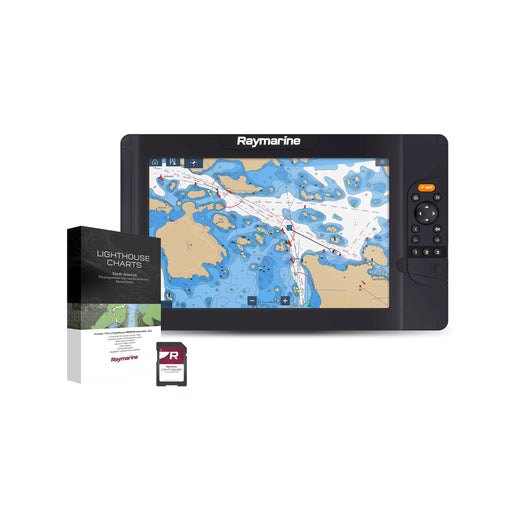
Raymarine Element 12 S - 12" MFD med Wi-Fi, GPS & LightHouse sjökort över norra Europa
Raymarine
Out of stock
Raymarine Element S-serien är din nyckel till smidig och prisvärd prestanda på sjön. Med en kraftfull fyrkärnig processor och en snabb och exakt 10...
View full details
Original price
17 990 kr
-
Original price
17 990 kr
Original price
17 990 kr
17 990 kr
17 990 kr
-
17 990 kr
Current price
17 990 kr
Sold out